
This is going to be a SUPER quick post as this is a SUPER small (but useful!) viz that I whipped up. I literally have about 6-7 vizzes that I could put out but I'm working on an actual big story at the moment that I'm hoping to get picked up by some news organizations so I want to really give it the TLC it deserves. So this week instead of a deep dive you get a shallow wade into a more useful than data-filled viz!
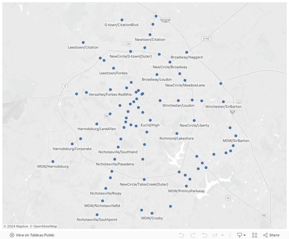
I was poking around looking for some things to work with as far as GeoJSON data (which the new Tableau 10.2 supports!) and I came across the "New Mapping" group out of UK. I poked around a little on their github page and found the GeoJSON for all the Lexington Traffic Cameras! I thought, "Wow, this is neat!" and started building my viz around it... then I thought, "STOP!"...
Where did this data come from? Was it being used anywhere else!? Then I found it... Lexington Fayette Urban County Government had already built a site for this!

Then I realized their site doesn't reformat to mobile and while it does provide live video streams (for about 5 seconds before auto-closing) it required a click on each camera to show the data. This seemed like an unnecessary step so I made the dash below so that if you hover over a point the still image camera data will show immediately (and will refresh upon scrolling over another and back over again). Additionally I created a mobile-specific version formatted for phones! It isn't much but sometimes just improving a UI can mean a huge difference in the utilization of a tool!
 |
| The question I always ask myself when re-doing someone else's work |
Click the image below for the mobile version or continue to scroll down for the desktop interface:

As always if you have any questions hit me up in the comments below or on Twitter @wjking0.
No comments:
Post a Comment